The city: districts, roads and shortcuts
The city of Urban Chaos .io is about 2.1 km on each side, with 142.6 km of roads, 1,101 intersections and 1,024 city blocks. Every player of an arena drives in the same city at the same time, together with 800 traffic vehicles and dozens of bots. Knowing the map is a real advantage: it tells you where to hunt, where to hide and which shortcut to take.
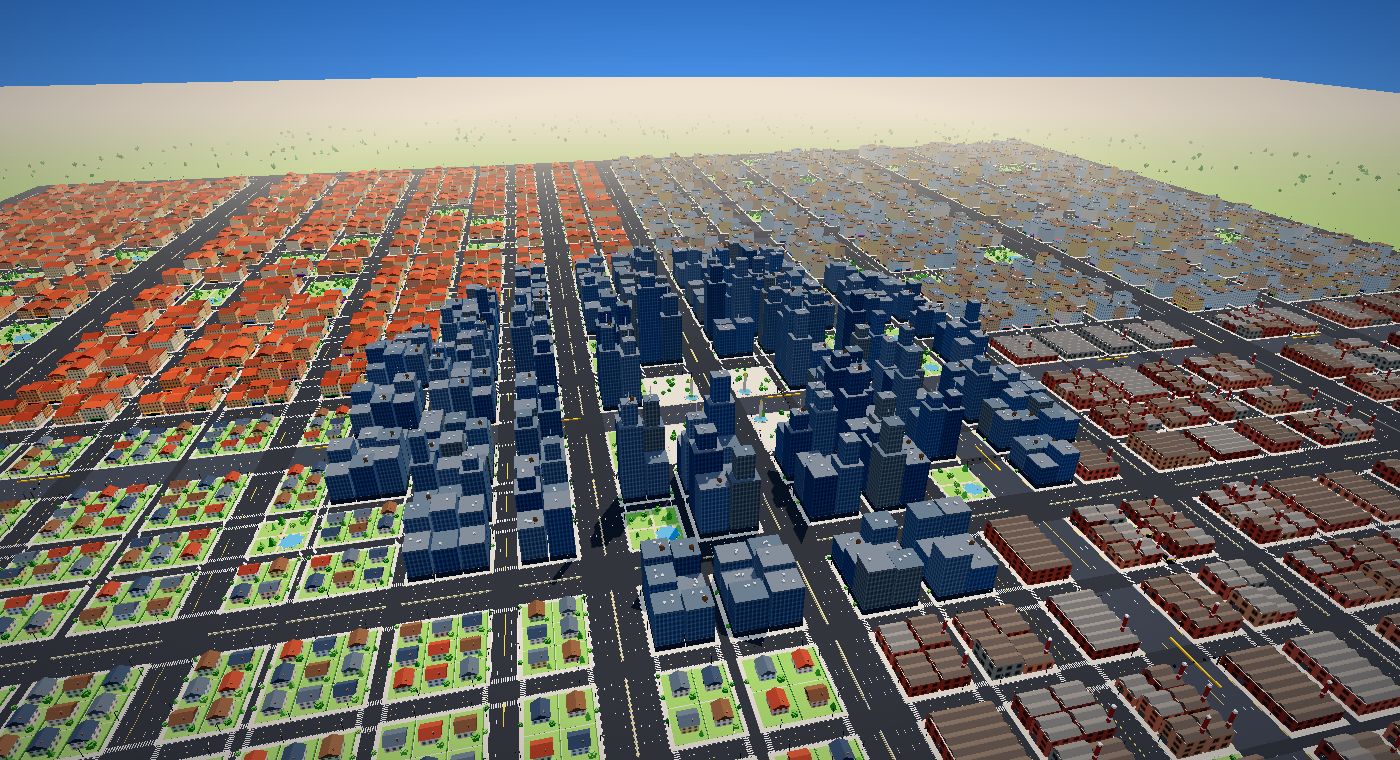
Districts
Downtown
The dense center of the city: glass towers, short blocks and intersections every few seconds. Traffic is heavy, which makes it the best hunting ground for small and mid-size vehicles, and a dangerous one when giants pass through.
The Arena
The very center of downtown, where the main roads of every district meet. Expect chaos: it is where players cross paths most often.
Industrial Zone
Warehouses, chimneys and long straight roads in the north-east. Trucks and semis feel at home here, and the toll expressway runs east from downtown along its southern edge.
Residential
Apartment buildings and family homes in the north-west, with many narrow streets and alleys: the best district to escape a bigger vehicle while you are still small.
Green Suburbs
Houses, lawns and parks in the south-east. Wide streets and long lines of sight: you see threats coming from far away.
Old Town
Red roofs and a tight grid in the south-west. Lots of one-way streets: read the arrows before you commit to a turn.
Road types
| Road | Lanes (each way) | Total length | Notes |
|---|---|---|---|
| Ring mega highway | 8 + 8 | 12.3 km | Sixteen lanes around the city, concrete median, no oncoming lane |
| Highways | 4 to 6 | 14.4 km | Fast, divided, ideal for long trips across the city |
| Toll expressway | 4 + 4 | 4.1 km | The fastest surface road; $15 to enter |
| Avenues | 2 to 4 | 30.9 km | Main roads of every district |
| Boulevards | 0 to 4 | 18.5 km | Often one-way |
| Streets | 0 to 2 | 32.8 km | Short and dense; one-way streets are common |
| Alleys | 1 + 1 | 18.4 km | Level 3 maximum: the safe escape route of small cars |
| Toll tunnels | 1 + 1 | 11.1 km | 6 underground shortcuts, $15, fastest roads of the game |
Tunnels
The 6 toll tunnels run under the city between surface portals. Inside, a badge shows the distance to the exit and the walls follow the gallery; where two galleries cross, the walls open so you can see the other traffic. Tunnels are the fastest way to cross the city, and a smart way to lose a pursuer, but remember that you cannot leave them until the exit.
Reading the map
The minimap in the top-left corner shows the streets around you and nearby vehicles as colored dots. Tap it (or press M) to open the full city map with every player and bot: green dots are prey, red dots are threats, yellow dots are your level. The district name and the type of road you are on are written under the minimap.
▶ PLAY FREE NOWNo download · browser and mobile